
News
Low-flying planes over Killarney map Kerry’s Geology

Photos by Padraig Healy
Low-flying aircraft spotted over Killarney this week were part of the Geological Survey Ireland’s Tellus national airborne mapping programme.
The survey, which is now in its final phase, is gathering geochemical and geophysical data on rocks, soil and water in Kerry and Clare. Two white twin-propeller planes with red tails, black stripes and the word “SURVEY” on their sides are carrying the scientific equipment needed for the work.
Flying in a grid pattern, the aircraft operate at altitudes of around 60 metres in rural areas and 240 metres over towns, allowing precise measurements to be taken. The planes are based at Shannon Airport under a permit from the Irish Aviation Authority.
The Tellus survey began 14 years ago and aims to have 100% of Ireland mapped by the end of 2025. All data collected is published free of charge on the Geological Survey Ireland website, where it is used to improve geological maps, support environmental and agricultural research, and assist in studies on issues such as radon gas and peatland mapping.
Minister for Housing, Local Government and Heritage, Darragh O’Brien, has said the survey will make Ireland one of the best geophysically mapped countries in the world, with benefits for research, natural resource management and the economy.
News
New Sunday date for 30th anniversary Historic Rally
The Killarney Towers Hotel Killarney Historic Rally will move to a new Sunday date for its 30th anniversary running. The event is scheduled to take place on Sunday, November 29, […]

News
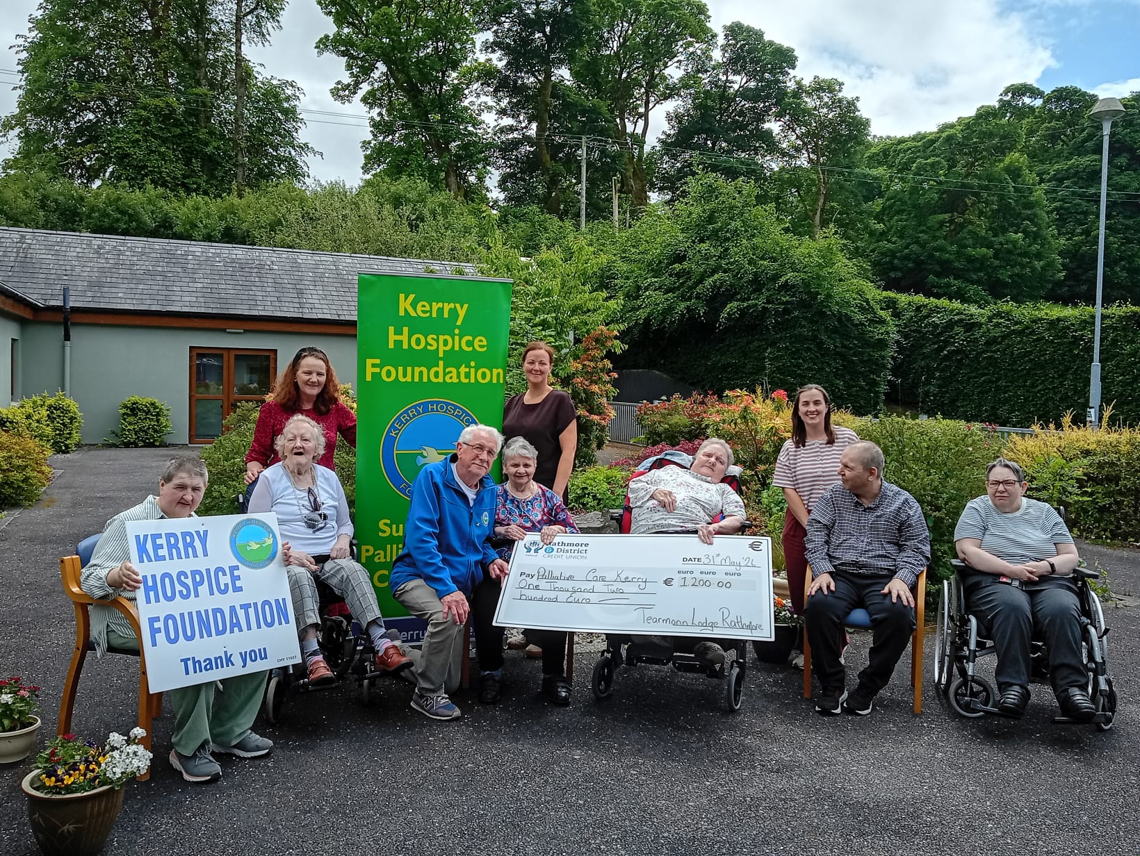
Rathmore’s Tearmann Lodge raises €1,200 for Kerry Hospice
The staff and residents at Tearmann Lodge in Rathmore recently came together to raise €1,200 for the Kerry Hospice Foundation . The facility, which is run by the Kerry Parents […]


New Sunday date for 30th anniversary Historic Rally
The Killarney Towers Hotel Killarney Historic Rally will move to a new Sunday date for its 30th anniversary running. The...


Rathmore’s Tearmann Lodge raises €1,200 for Kerry Hospice
The staff and residents at Tearmann Lodge in Rathmore recently came together to raise €1,200 for the Kerry Hospice Foundation...


Overnight water restrictions in Greater Killarney
Overnight water restrictions in Greater Killarney Uisce Éireann has introduced overnight water restrictions across parts of Greater Killarney to help...


West End and Great Southern team up for theatre experience
A powerful production of one of Ireland’s most celebrated contemporary plays is coming to the Killarney stage this month. In...

Fans urged to leave points on field
Fans urged to leave points on field Kerry fans travelling to Croke Park for the All-Ireland Senior Football Final on...


Fossa Swimmers make a splash at County Finals
The Fossa Swim team pictured at the Tralee Sports Complex following their successful outing at the County Finals of the...


On the Ball Part 2 of the Mikey Daly Interview
Éamonn Fitzgerald EF: Killarney Celtic are invited to participate in an Irish competition. That has big financial implications for travel,...


LUKE MANGAN recently caught up with Kerry FC’s manager, Colin Healy.
He spoke to him about his careers as a player and manager. Here’s how it went: When you began your...


Home cup tie for St Paul’s could be epic
Paudie O’Connor National Cup (Round 1) Utility Trust St Paul’s v GCU Brunell Saturday 7.30pm Killarney Sports and Leisure Centre...


Chances of Kerry v Cork Munster final in 2026 decrease as Munster GAA delay seeding plan
After facing a backlash from Limerick, Clare, Waterford and Tipperary players, Munster GAA have postponed their plan to keep Cork...